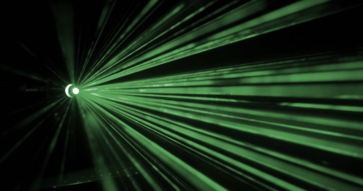
Lidar or light detection and ranging is an active remote sensing method and digital imaging technique that involves firing pulses of near-infrared, visible light, or ultraviolet to measure the distance between the target points and the sensor-equipped source. Specifically, it works by measuring how long it takes for different emitted pulses to return or reflect back to the sensor. The process allows the production of three-dimensional digital images based on the differences in return times and wavelengths. It is worth mentioning that the operational principle behind lidar is similar to sonar, which uses soundwaves, and radar, which uses radio waves and microwaves.
Advantages and Applications of Lidar
The technology has important industrial, commercial, and scientific applications. For starters, it has been useful in producing high-resolution maps, thus, making it applicable in the fields of geography, geology, geomatics, geomorphology, archaeology, atmospheric physics, precision agriculture and forestry, and mining, among others.
Other notable applications include control and safety in some autonomous vehicle technologies, as well as navigation assistance in transportation systems. In consumer electronics, the technology has been used to promote augmented reality features found in smartphone and tablet computer devices. The iPad Pro 2020 from Apple Inc. comes with a lidar sensor. Another us is in biometrics via facial recognition technology.
There are also some notable police and military uses. Traffic enforces use lidar-based speed guns to enforce speed limits. In forensics, the technology enables the digital mapping of a crime scene, and precise recording of object placements and other relevant information for documentation and later review. The military uses different lidar applications to include geoinformation gathering, target identification, and identification of biological warfare agents.
Below are the specific advantages:
1. Inexpensive and Reliable: One of the primary advantages of lidar is that it is considerably economical when compared to other surveying methods or imaging techniques such as photography but more precise than sonar and radar when it comes to producing detailed images. What makes it more economical is its speed. It can cover 1000 sq-km area in 12 hours and generate digital evaluation models of a 1000 sq-km area in 24 hours
2. Expansive Imaging Scope: The technology can also survey a wider surface area compared to photography and photogrammetry. It is also useful for mapping inaccessible locations such as mountainous areas or places with thick snows. Note that light pulses can also reach beneath the canopy of some forest areas, unlike photogrammetry.
3. Precise and Accurate: Remember that it is more precise than other remote sensing methods such as sonar and radar. It is capable of collecting elevation data in dense forests. It is also not affected by geometric distortions such as angular landscapes. It is essentially useful in applications in which the detection of exact shapes and size of objects are critical. The vertical accuracy of lidar is between 5 and 15 cm, while its horizontal accuracy is between 30 to 50 cm.
4. Minimum Human Dependence: Another advantage of lidar is that most of the underlying processes are automated, thus minimizing human dependence, unlike in photogrammetry, global positioning system, and land surveying. This advantage translates further to cost efficiency and having more time for data analysis and report generation.
5. Versatile Technology: Light detection and ranging is compatible with other surveying methods and imaging techniques. It can be used alongside sonar or radar systems to address its limitations and complement one another. The data generated by this technology can also be integrated with other data sources for more in-depth analyses.
Disadvantages and Limitations of Lidar
Remember that lidar is one of the numerous methods and techniques for surveying and digital image generation. The principle behind this technology is somewhat similar to wireless transmission and communication via optical technology.
Nevertheless, based on the advantages mentioned and detailed above, it undeniably has practical applications across different fields and use cases. Of course, this technology is not perfect, and depending on the situation or requirement, it might not be suitable.
Below are the specific disadvantages:
1. Reflectivity Limitations: A notable disadvantage of lidar is that it does not work well in situations in which there are high sun angles or huge reflections from another light source. It is also unreliable when used on unreflective surfaces such as high water depth or ununiform water surfaces. Note that the technology works based on the principle of light reflection.
2. Environmental Considerations: The technology has limited applications in harsh environments, especially in specific weather conditions such as rainfall, snowfall, and hail, or when there are low-hanging clouds. Radar works best under these conditions. Furthermore, sonar works best underwater because of the reflectivity limitations of light pulses.
3. Data Processing Requirement: Because lidar can cover a wider surface area at a faster rate, it tends to generate too much data. An organization might not be suitably equipped to process and interpret large amounts of data they will be collecting. This is the reason why most organizations subcontract from other firms to address their big data analytics requirements.
4. Distance Limitations: Another drawback of lidar is that it has a low operating altitude of between 500 meters and 2000 meters. The pulses it emits will not be effective at higher altitudes. Note that radar is more suitable in farther distances and when detection distance is more important than the exact size and shape of surface objects.
5. Issues with Thick Vegetations: It is also unsuitable for use in dense forest areas with thick canopies or vegetations. Firing light pulses in this situation might result in incomplete data collection or inaccurate measurement and imaging. Light cannot penetrate these obstructions, unlike radio waves and microwaves.